基達爾
基達爾(法語:)為馬利基達爾區的城市,為基達爾區首府,位於馬利東北部、伊福拉斯山脈南側。距西南方的加奧285公里,以稱為「直線」的342公里長無舖面道路與之連接。居民以游牧民族圖瓦雷克族為主。
| 基達爾 | |
|---|---|
| 縣級行政區及城鎮 | |
 基達爾入口標誌 | |
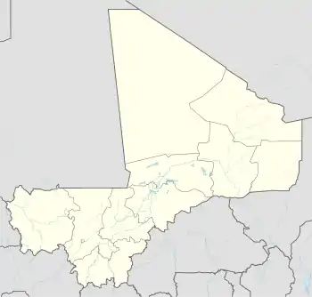 基達爾 在馬里的位置 | |
| 坐标:18°26′N 1°24′E | |
| 國家 | |
| 大區 | 基達爾區 |
| 縣 | 基達爾縣 |
| 人口(2009年)[1] | |
| • 總計 | 25,617人 |
2013年初,法國軍隊擊敗伊斯蘭激進武裝後,阿扎瓦德民族解放运动趁機控制了基達爾。[2]
| 馬利基達爾 | ||||||||||||||||||||||||||||||||||||||||||||||||||||||||||||
|---|---|---|---|---|---|---|---|---|---|---|---|---|---|---|---|---|---|---|---|---|---|---|---|---|---|---|---|---|---|---|---|---|---|---|---|---|---|---|---|---|---|---|---|---|---|---|---|---|---|---|---|---|---|---|---|---|---|---|---|---|
| 氣候圖表(說明) | ||||||||||||||||||||||||||||||||||||||||||||||||||||||||||||
| ||||||||||||||||||||||||||||||||||||||||||||||||||||||||||||
| ||||||||||||||||||||||||||||||||||||||||||||||||||||||||||||
參考文獻
This article is issued from Wikipedia. The text is licensed under Creative Commons - Attribution - Sharealike. Additional terms may apply for the media files.