帕尔默站
帕尔默站多为对海洋生物进行研究。站内设有网络监测地震,大气和紫外线辐射的设备。其他研究以物理海洋学,海洋地质学和海洋生物学为主。[1]
| 概览 | |||||||||||
|---|---|---|---|---|---|---|---|---|---|---|---|
| 机场类型 | 冰川区 | ||||||||||
| 所有者 | 国家科学基金会 | ||||||||||
| 營運者 | 国家科学基金会 | ||||||||||
| 服務城市 | 帕尔默站 | ||||||||||
| 地理位置 | 南极洲 | ||||||||||
| 跑道 | |||||||||||
| |||||||||||
| 帕尔默站 | |
|---|---|
 帕尔默站(2013年1月) | |
| 概要 | |
| 用途 | year-round Antarctic facility[*] |
| 地點 | 葛拉漢地昂韋爾島 |
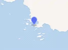
| 坐标 | 64°46′27″S 64°03′11″W |
| 启用日 | 1968年 |
| 地圖 | |
| |
注释
- http://realcoldfish.wordpress.com/ Blog of on-going research project based at Palmer Station July-September 2008
外部链接
- Blog of on-going research project based at Palmer Station July-September 2008
- Website about Palmer Station
- Map of the area
- Report from an adventure trip to Anvers Island with pictures
- British Antarctic Survey 页面存档备份,存于
- Stanford Very Low Frequency Research at Palmer Station
- Website about Palmer Station with picture.
- Picture
- A Palmer Station visit diary with pictures
- Another Palmer Station visit diary with pictures
- Long term ecological research on Palmer Station 页面存档备份,存于
- NSF (National Science Foundation) Ultraviolet (UV) Monitoring Network with picture
- Scientists map ocean floor near Palmer Station
- US icebreakers
- Usap Palmer Station webcam
- COMNAP Antarctic Facilities
- COMNAP Antarctic Facilities Map
- USGS Seismic station data
This article is issued from Wikipedia. The text is licensed under Creative Commons - Attribution - Sharealike. Additional terms may apply for the media files.