怀特河 (密苏里河支流)
怀特河(英語:)是密苏里河的一条支流,长约580英里(930)[3],流经美国的內布拉斯加州和南达科他州,这名称源自流经恶地国家公园时,河水中混入的火山灰和泥沙,而显得灰白的颜色[5][6],流域面积约10,200平方英里(26,000平方),其中约8,500平方英里(22,000平方)在南达科他州[7]。
| White River 怀特河 | |
 Near Crawford, Nebraska | |
| 国家 | |
|---|---|
| 省/州/邦 | |
| 县 | 道斯縣、香農縣、彭寧頓縣、杰克逊县、瓊斯縣、梅萊特縣、特里普縣、萊曼縣 |
| 源头 | Pine Ridge |
| - 位置 | 内布拉斯加州道斯縣Harrison附近 |
| - 海拔 | 4,861 ft(1,482 m)[1] |
| 河口 | 密苏里河 |
| - 位置 | 南达科他州萊曼縣张伯伦附近 |
| - 海拔 | 1,601 ft(488 m)[2] |
| 长度 | 580 mi(933 km)[3] |
| 流域面积 | 10,200 mi²(26,000 km²)[4] |
| 流量 | |
| - 平均流量 | 570 ft³/s(0 m³/s)[4] |
| - 最大流量 | 51,900 ft³/s(1,500 m³/s) |
| - 最小流量 | 0 ft³/s(0 m³/s) |
 怀特河流域图
| |
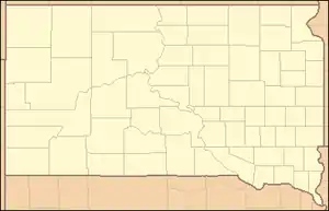
 怀特河河口在南达科他州的位置
| |
参考文献
- Source elevation derived from Google Earth search using GNIS source coordinates.
- . United States Geological Survey. [March 30, 2011]. (原始内容存档于2012-04-05).
- Benke and Cushing, p. 471
- Benke and Cushing, p. 445
- Federal Writers' Project. . University of South Dakota. 1940: 6.
- Hogan, Edward Patrick; Fouberg, Erin Hogan. Third. Sioux Falls, SD: The Center for Western Studies – Augustana College. 2001. ISBN 0-931170-79-6.
This article is issued from Wikipedia. The text is licensed under Creative Commons - Attribution - Sharealike. Additional terms may apply for the media files.