格兰比 (魁北克省)
| 格蘭比 Granby | ||
|---|---|---|
| 鎮 | ||
 大街 | ||
| ||
| 格言:Pour y parvenir | ||
 Location within La Haute-Yamaska RCM. | ||
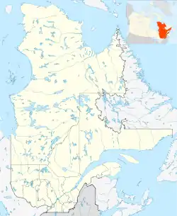 格蘭比 在魁北克的位置 | ||
| 坐标:45°24′N 72°44′W[1] | ||
| 國家 | ||
| 省 | ||
| 魁北克省地區列表 | 蒙泰雷吉 | |
| RCM | 上亞馬斯卡 | |
| 組成 | 2007年1月1日 | |
| 政府[2][3] | ||
| • 市長 | Pascal Bonin | |
| • 聯邦選區 | 謝福德 | |
| • 省選區 | 格蘭比 | |
| 面积[2][4] | ||
| • 鎮 | 156.10 平方公里(60.27 平方英里) | |
| • 陸地 | 152.72 平方公里(58.97 平方英里) | |
| • 市區[5] | 90.53 平方公里(34.95 平方英里) | |
| • 都會區[6] | 396.52 平方公里(153.10 平方英里) | |
| 人口(2011)[4] | ||
| • 鎮 | 63,433人 | |
| • 密度 | 415.3人/平方公里(1,076人/平方英里) | |
| • 市区[5] | 60,281 | |
| • 市区密度 | 665.8人/平方公里(1,724人/平方英里) | |
| • 都會區[6] | 77,077 | |
| • 都會區密度 | 194.4人/平方公里(503人/平方英里) | |
| • Pop 2006-2011 | ▲ 6.8% | |
| • Dwellings | 29,131 | |
| 时区 | EST(UTC−5) | |
| • 夏时制 | EDT(UTC−4) | |
| 郵政編號 | J2G-J2J | |
| 電話區號 | 450及579 | |
| 公路 | ||
| 網站 | www | |

參考文獻
- . [2019-05-14]. (原始内容存档于2013-09-29).
- Parliament of Canada Federal Riding History: SHEFFORD (Quebec)
- 2011 Statistics Canada Census Profile: Granby, Quebec
- . 2012-10-22 [3 November 2012].
- 2011 Statistics Canada Census Profile: Granby (Census agglomeration), Quebec. The census agglomeration consists of Granby, Bromont, Saint-Alphonse-de-Granby, Saint-Paul-d'Abbotsford. In the 2006 census, the census agglomeration had not included Saint-Paul-d'Abbotsford.
This article is issued from Wikipedia. The text is licensed under Creative Commons - Attribution - Sharealike. Additional terms may apply for the media files.