阿卡胡特拉
阿卡胡特拉(西班牙語:)是萨尔瓦多的一座城市,位于松索纳特省,地处中美洲太平洋沿岸。该城市是萨尔瓦多的主要港口之一。
| 阿卡胡特拉 | |
|---|---|
| 城市 | |
_is_moored_in_Acajutla%252C_El_Salvador%252C_during_a_scheduled_port_visit.jpg.webp) | |
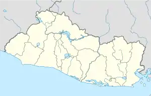 阿卡胡特拉 阿卡胡特拉位于萨尔瓦多的位置 | |
| 坐标:13°35′24″N 89°50′01″W | |
| 国家 | |
| 省 | 松索纳特省 |
| 面积 | |
| • 总计 | 166.59 平方公里(64.32 平方英里) |
| 海拔 | 24 米(79 英尺) |
| 人口(2012) | |
| • 總計 | 29,701人 |
| • 密度 | 180人/平方公里(460人/平方英里) |
| 时区 | 北美中部时区(UTC-6) |
历史
1524年,墨西哥总督埃爾南·科爾特斯任命佩德羅·德·阿爾瓦拉多征服墨西哥南部地区,在到达阿卡胡特拉地区之前,阿尔瓦拉多已经占领了危地马拉。尽管当地原住民奋力抵抗,但在阿卡胡特拉之战一役后,所有土著势力均被击败。
1841年中美洲联邦解体,萨尔瓦多宣布独立。咖啡的出口逐渐成为萨尔瓦多的经济基础,而阿卡胡特拉则利用运输的便捷取得了投资者和种植园园主的关注,该地区的基础建设因此逐渐得到了发展。
在1932年萨尔瓦多农民起义期间,为保护英国居民在萨尔瓦多的利益,加拿大皇家海軍应英国政府要求派出两艘驱逐舰停泊在阿卡胡特拉港口[1]。
地理
_hospital_ship_USNS_Comfort_(T-AH_20)_is_moored_in_Acajutla%252C_El_Salvador.jpg.webp)
气候
根据柯本气候分类法,阿卡胡特拉属于熱帶乾濕季氣候。与其他中美洲太平洋沿岸的国家相同,阿卡胡特拉的气候炎热且潮湿,白天的温度通常能达到32°C至34°C[2]。
| 阿卡胡特拉(1961–1990,极端气候数据起始于1954)气候平均数据 | |||||||||||||
|---|---|---|---|---|---|---|---|---|---|---|---|---|---|
| 月份 | 1月 | 2月 | 3月 | 4月 | 5月 | 6月 | 7月 | 8月 | 9月 | 10月 | 11月 | 12月 | 全年 |
| 历史最高温℃(℉) | 38.5 (101.3) |
39.5 (103.1) |
40.2 (104.4) |
39.3 (102.7) |
39.3 (102.7) |
38.2 (100.8) |
38.1 (100.6) |
38.0 (100.4) |
36.5 (97.7) |
38.5 (101.3) |
38.0 (100.4) |
38.2 (100.8) |
40.2 (104.4) |
| 平均高温℃(℉) | 32.2 (90) |
32.3 (90.1) |
32.6 (90.7) |
32.8 (91) |
32.2 (90) |
31.5 (88.7) |
32.0 (89.6) |
31.9 (89.4) |
31.1 (88) |
31.7 (89.1) |
32.2 (90) |
32.3 (90.1) |
32.1 (89.8) |
| 每日平均气温℃(℉) | 26.0 (78.8) |
26.5 (79.7) |
27.6 (81.7) |
28.4 (83.1) |
28.1 (82.6) |
26.3 (79.3) |
27.1 (80.8) |
27.0 (80.6) |
25.5 (77.9) |
26.7 (80.1) |
27.5 (81.5) |
26.2 (79.2) |
26.9 (80.4) |
| 平均低温℃(℉) | 21.8 (71.2) |
22.2 (72) |
23.2 (73.8) |
24.0 (75.2) |
24.2 (75.6) |
22.6 (72.7) |
23.1 (73.6) |
22.3 (72.1) |
23.0 (73.4) |
23.1 (73.6) |
22.3 (72.1) |
22.1 (71.8) |
22.8 (73) |
| 历史最低温℃(℉) | 17.2 (63) |
16.1 (61) |
17.8 (64) |
17.4 (63.3) |
18.9 (66) |
19.5 (67.1) |
18.2 (64.8) |
16.6 (61.9) |
17.8 (64) |
17.0 (62.6) |
15.6 (60.1) |
16.9 (62.4) |
15.6 (60.1) |
| 平均降雨量㎜(英寸) | 3 (0.12) |
1 (0.04) |
12 (0.47) |
54 (2.13) |
166 (6.54) |
316 (12.44) |
256 (10.08) |
306 (12.05) |
386 (15.2) |
188 (7.4) |
64 (2.52) |
5 (0.2) |
1,757 (69.17) |
| 平均降雨日数(≥ 0.1 mm) | 1 | 0 | 2 | 5 | 10 | 17 | 17 | 17 | 17 | 12 | 3 | 1 | 100 |
| 平均相对湿度(%) | 68 | 69 | 69 | 72 | 76 | 81 | 80 | 78 | 82 | 81 | 73 | 69 | 75 |
| 每月平均日照时数 | 303.8 | 285.3 | 300.7 | 261.0 | 248.0 | 204.0 | 260.4 | 263.5 | 207.0 | 235.6 | 273.0 | 303.8 | 3,146.1 |
| 每日平均日照时数 | 9.8 | 10.1 | 9.7 | 8.7 | 8.0 | 6.8 | 8.4 | 8.5 | 6.9 | 7.6 | 9.1 | 9.8 | 8.6 |
| 来源 #1:NOAA[3] | |||||||||||||
| 来源 #2:德国气象服务 (humidity 1956–1966, rainy days 1973–1992, and sun 1954–1966),[4] Meteo Climat (record highs and lows)[5] | |||||||||||||
脚注
- Marc Milner, "The Invasion Of El Salvador: Navy, Part 14", Legion Magazine, 1 March 2006. Accessed 22 January 2011.
- Climate Summary for Acajutla
- . 美国国家海洋和大气管理局. [March 24, 2015].
- (PDF). Baseline climate means (1961-1990) from stations all over the world. Deutscher Wetterdienst. [May 2, 2017]. (原始内容存档 (PDF)于2019-07-13) (德语).
- . Meteo Climat. [May 2, 2017]. (原始内容存档于2019-07-13) (法语).
来源
- "Acajutla" 页面存档备份,存于. 2006. Encyclopædia Britannica. Encyclopædia Britannica Online Library Edition. (Retrieved 16 September 2006).
- "CENTRAL AMERICA: Interesting Record of the Voyage of the Steamship Columbus from Panama to Central American Ports — Trade of the Coast — Agriculture in Guatemala — Cochineal and Indigo Trade in Guatemala and Salvador — Increase in the Growth of Coffee in Salvador — Facilities of Trade — General News, etc.." New York Times (1857-Current file), 29 January 1858 (Accessed via ProQuest 页面存档备份,存于 17 September 2006).
- Meislin, Richard J. "5 Key Leaders of the Opposition Reported Kidnapped in Salvador." New York Times. 23 October 1982. (Accessed via Proquest 页面存档备份,存于, 17 September 2006).
- Snaden, James N. "El Salvador". Lands and Peoples. Grolier Online. (Retrieved 16 September 2006)
- "Trade with Central America and with the States of the South Pacific, via Isthmus of Panama." New York Times. 17 July 1858. (Accessed via Proquest 页面存档备份,存于, 17 September 2006).
- Woodward, Jr., Ralph L. "El Salvador". Encyclopedia Americana. Grolier Online. (Retrieved 16 September 2006).
This article is issued from Wikipedia. The text is licensed under Creative Commons - Attribution - Sharealike. Additional terms may apply for the media files.