倫敦盆地
倫敦盆地(London Basin)是以英國倫敦為中心的一個狹長、三角形的沉積盆地,除去大倫敦外,它還包括了東安格利亞東南部和英格蘭東南英格蘭的部分地區,最東端緊鄰北海。它形成于4000至6000万年前古近紀的阿尔卑斯造山运动時期。倫敦盆地主要由泰晤士河灌溉,但其面積並不完全重疊。 位于盆地中的大倫敦都會區有近1000万居民[1]。
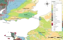
倫敦盆地的地理位置
倫敦盆地東西向的橫截面
參考文獻
- Brenchley, P.J. & Rawson, P.F.; 2006: The geology of England and Wales, Geological Society of London (2nd ed.), ISBN 1-86239-200-5.
- Gradstein, F.M.; Ogg, J.G. & Smith, A.G.; 2004: A Geologic Time Scale 2004, Cambridge University Press.
- Jackson, A.A.; 2008: Bedrock geology UK south. An explanation of the bedrock geology map of England and Wales – 1:625,000 edition, Keyworth, Nottingham, British Geological Survey, ISBN 978-0-85272-586-3.
This article is issued from Wikipedia. The text is licensed under Creative Commons - Attribution - Sharealike. Additional terms may apply for the media files.
