克佩特山脈
克佩特山脈(波斯語:;土庫曼語:[註 1])是位於伊朗和土庫曼斯坦邊境的山脈,長約650千米。山脉从西北部里海向东南部哈里河绵延,[1]其最高峰海拔2940米,位于土库曼斯坦阿什哈巴德西南部。[2]
| 克佩特山脈 | |
|---|---|
| خرِبِت كُپِتدَگ | |
 克佩特山脈(摄于土库曼斯坦阿哈爾平原) | |
| 规模 | |
| 长度 | 650(400英里) |
| 地理 | |
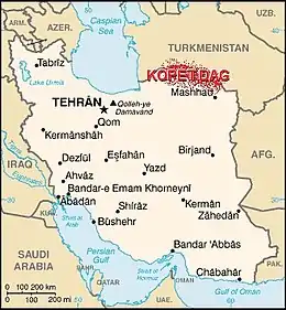 克佩特山脈在伊朗的位置。
| |
| 国家 | 伊朗和土库曼斯坦 |
备注
- ö的发音为[ø]。
参考来源
- Microsoft Encarta World Atlas, 2001, Microsoft Corporation
- Kopet-Dag Range, Encyclopedia Britannica, www.britannica.com
This article is issued from Wikipedia. The text is licensed under Creative Commons - Attribution - Sharealike. Additional terms may apply for the media files.
