圣约翰 (安提瓜和巴布达)
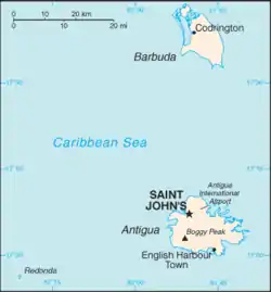
圣约翰(英語:)是安提瓜和巴布达的首都,位于北纬17°07′西经61°51′。人口31,000(2005年)。圣约翰位於安提瓜岛西北岸,屬圣约翰区,是全国的经济中心和岛上的主要港口。自从1632年,安提瓜和巴布达成为殖民地起,圣约翰就一直是该地的行政中心。
| St. John's, Antigua and Barbuda (V. C. Bird International Airport)气候平均数据 | |||||||||||||
|---|---|---|---|---|---|---|---|---|---|---|---|---|---|
| 月份 | 1月 | 2月 | 3月 | 4月 | 5月 | 6月 | 7月 | 8月 | 9月 | 10月 | 11月 | 12月 | 全年 |
| 历史最高温℃(℉) | 31.2 (88.2) |
31.8 (89.2) |
32.9 (91.2) |
32.7 (90.9) |
34.1 (93.4) |
32.9 (91.2) |
33.5 (92.3) |
34.9 (94.8) |
34.3 (93.7) |
33.2 (91.8) |
32.6 (90.7) |
31.5 (88.7) |
34.9 (94.8) |
| 平均高温℃(℉) | 28.3 (82.9) |
28.4 (83.1) |
28.8 (83.8) |
29.4 (84.9) |
30.2 (86.4) |
30.6 (87.1) |
30.9 (87.6) |
31.2 (88.2) |
31.1 (88) |
30.6 (87.1) |
29.8 (85.6) |
28.8 (83.8) |
29.8 (85.6) |
| 每日平均气温℃(℉) | 25.4 (77.7) |
25.2 (77.4) |
25.6 (78.1) |
26.3 (79.3) |
27.2 (81) |
27.9 (82.2) |
28.2 (82.8) |
28.3 (82.9) |
28.1 (82.6) |
27.5 (81.5) |
26.8 (80.2) |
25.9 (78.6) |
26.9 (80.4) |
| 平均低温℃(℉) | 22.4 (72.3) |
22.2 (72) |
22.7 (72.9) |
23.4 (74.1) |
24.5 (76.1) |
25.3 (77.5) |
25.3 (77.5) |
25.5 (77.9) |
25.0 (77) |
24.4 (75.9) |
23.9 (75) |
23.0 (73.4) |
24.0 (75.2) |
| 历史最低温℃(℉) | 15.5 (59.9) |
16.6 (61.9) |
17.0 (62.6) |
16.6 (61.9) |
17.8 (64) |
19.7 (67.5) |
20.6 (69.1) |
19.3 (66.7) |
20.0 (68) |
20.0 (68) |
17.7 (63.9) |
16.1 (61) |
15.5 (59.9) |
| 平均降水量㎜(英寸) | 56.6 (2.228) |
44.9 (1.768) |
46.0 (1.811) |
72.0 (2.835) |
89.6 (3.528) |
62.0 (2.441) |
86.5 (3.406) |
99.4 (3.913) |
131.6 (5.181) |
142.2 (5.598) |
135.1 (5.319) |
83.4 (3.283) |
1,049.2 (41.307) |
| 平均降水日数(≥ 1.0 mm) | 11.1 | 8.7 | 7.3 | 7.2 | 8.6 | 8.3 | 11.8 | 12.7 | 12.0 | 12.9 | 12.4 | 12.1 | 124.7 |
| 来源:Antigua/Barbuda Meteorological Services[1][2] | |||||||||||||
- . Antigua and Barbuda Meteorological Services. [14 October 2012]. (原始内容存档于2019-08-23).
- . Antigua and Barbuda Meteorological Services. [14 October 2012]. (原始内容存档于2020-02-24).
| 圣约翰 St. John's | |
|---|---|
| 市 | |
 市中心 | |
 圣约翰位置 | |
| 坐标:17°07′N 61°51′W | |
| 国家 | |
| 岛屿 | 安提瓜岛 |
| 区 | 圣约翰区 |
| 建立 | 1632年 |
| 語源 | 圣约翰 |
| 面积 | |
| • 总计 | 10 平方公里(4 平方英里) |
| 海拔 | 0 米(0 英尺) |
| 人口(2011年) | |
| • 總計 | 22,193人 |
| • 密度 | 2,200人/平方公里(5,700人/平方英里) |
| 时区 | AST(UTC-4) |
| 气候 | 热带草原气候 |
This article is issued from Wikipedia. The text is licensed under Creative Commons - Attribution - Sharealike. Additional terms may apply for the media files.
