安德森縣 (德克薩斯州)
安德森县(英語:)是美國德克薩斯州東部的一個縣。面積2,792平方公里。根據2010年人口普查,共有人口55,109人。[1]根據2010年人口普查,共有人口58,458人。[2]>縣治巴勒斯坦(Palestine)。[3]
| 德克薩斯州安德森縣 | |
|---|---|
| 地圖 | |
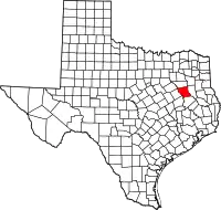 安德森縣於德克薩斯州內的地理位置 | |
 美國德克薩斯州的地理位置 | |
| 統計資料 | |
| 成立時間 | 1846年 |
| 名取自 | K·L·安德森(Kenneth L. Anderson) |
| 治 | 巴勒斯坦 |
| 最大城市 | 巴勒斯坦 |
| 面積 - 全部 | 2792 km²(1078 mi²) |
| - 陸地 | 2773 km²(1071 mi²) |
| - 水域 | 19 km²(7 mi²),0.66% |
| 人口 - 2010年 | 58458人 |
| - 密度 | 20人/km²(52人/mi²) |
| 時區 | 北美中部時區:UTC-6/-5 |
| 網站 | www.co.anderson.tx.us/ |
成立於1846年3月24日。縣名紀念德克薩斯共和國最後一任副總統K·L·安德森(Kenneth Lewis Anderson)。[4][5]
地理
根據2000年人口普查,安德森縣的總面積為1,078平方英里(2,790平方),其中有1,071平方英里(2,770平方),即99.34%為陸地;7平方英里(18平方),即0.66%為水域。[6]
國家保護區
- 內奇斯河國家野生動物保護區(部分)
人口
| 歷史人口數 | |||
|---|---|---|---|
| 調查年 | 人口 | %± | |
| 1850年 | 2,684 | — | |
| 1860年 | 10,398 | 287.4% | |
| 1870年 | 9,229 | −11.2% | |
| 1880年 | 17,395 | 88.5% | |
| 1890年 | 20,923 | 20.3% | |
| 1900年 | 28,015 | 33.9% | |
| 1910年 | 29,650 | 5.8% | |
| 1920年 | 34,318 | 15.7% | |
| 1930年 | 34,643 | 0.9% | |
| 1940年 | 37,092 | 7.1% | |
| 1950年 | 31,875 | −14.1% | |
| 1960年 | 28,162 | −11.6% | |
| 1970年 | 27,789 | −1.3% | |
| 1980年 | 38,381 | 38.1% | |
| 1990年 | 48,024 | 25.1% | |
| 2000年 | 55,109 | 14.8% | |
| 2010年 | 58,458 | 6.1% | |
| [7][8][9] | |||
根據2000年人口普查[1],安德森縣擁有55,109居民、15,678住戶和11,335家庭。[10]其人口密度為每平方英里52居民(每平方公里20居民)。[11]本縣擁有18,436間房屋单位,其密度為每平方英里17間(每平方公里7間)。[12]
参考文献
- . United States Census Bureau. [2008-01-31].
- 2010 census factfinder2
- . National Association of Counties. [2011-06-07].
- 德克薩斯百科全書
- . United States Geological Survey. 2007-10-25 [2008-01-31].
- . United States Census. [2011-02-13]. (原始内容存档于2012-06-06).
- . United States Census Bureau. [2013-05-06].
- . Factfinder2.census.gov. [2013-02-16].
- . Mapserver.lib.virginia.edu. [2013-02-16].
- (英文)Population Profile of the United States: 2000 页面存档备份,存于
- Statistical profile of Alger County, Michigan 的存檔,存档日期2012-04-07., United States Census Bureau, Census 2000
- (英文)State and County QuickFacts 的存檔,存档日期2004-04-01.
This article is issued from Wikipedia. The text is licensed under Creative Commons - Attribution - Sharealike. Additional terms may apply for the media files.
