德舒特河
德舒特河(英語:,/dəˈʃuːts/ )是俄勒冈州中部的一条河流,是哥伦比亚河的一条主要支流,全长406km,起源于小熔岩湖,汇集了喀斯喀特山脉东坡的许多河流,在俄勒冈州与华盛顿州的边界注入哥伦比亚河。
| Deschutes River | |
|---|---|
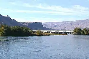 距离河口处不远的德舒特河。 | |
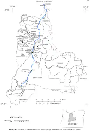 德舒特河流域图 | |
| 国家 | 美国 |
| 州 | 俄勒冈州 |
| 县 | 德舒特縣、傑佛遜縣、 謝爾曼縣、沃斯科縣 |
| 流域 | |
| 源頭 | Little Lava Lake |
| - 位置 | 俄勒冈州德舒特縣喀斯喀特山脉 |
| - 坐標 | 43°54′33″N 121°45′40″W[1] |
| - 海拔 | 4,747英尺(1,447米)[2] |
| 河口 | 哥伦比亚河 |
- 位置 | 謝爾曼縣和沃斯科縣交界处,Fairbanks和Biggs Junction之间 |
- 坐標 | 45°38′07″N 120°54′52″W[1] |
- 海拔 | 164英尺(50米)[1] |
| 面積 | 10,500 sq mi(27,000 km2)[3] |
| 本貌 | |
| 長度 | 252 mi(406 km)[4] |
| 流量 | |
无效指定 | |
| 類型 | Scenic, Recreational |
| 指定 | October 28, 1988 |
参考文献
- . Geographic Names Information System (GNIS). United States Geological Survey (USGS). November 28, 1980 [October 13, 2008].
- Source elevation derived from Google Earth search using GNIS source coordinates.
- (PDF). United States Geological Survey. 2014 [September 25, 2014].
- . TopoQuest. [October 13, 2008]. (原始内容存档于2012-09-25).
- The average discharge rate was calculated from USGS records from the Moody gauge of water years 1898–99 and 1907–2013.
外部链接
This article is issued from Wikipedia. The text is licensed under Creative Commons - Attribution - Sharealike. Additional terms may apply for the media files.