斯沃司
斯沃司 (愛爾蘭語:)是愛爾蘭芬戈郡的郡治,距離都柏林市中心以北13公里。隨著人口的增加,它是非官方的最大的城市(見人口統計節),並在不久的將來有望獲得城市的地位。芬戈郡議會斯沃司作為一個“新興城市”的估計,到2035年,斯沃司城將有10萬人口。
| 斯沃司 Sord[1] Sord Cholmcille | |
|---|---|
| Town | |
 北街,斯沃司 | |
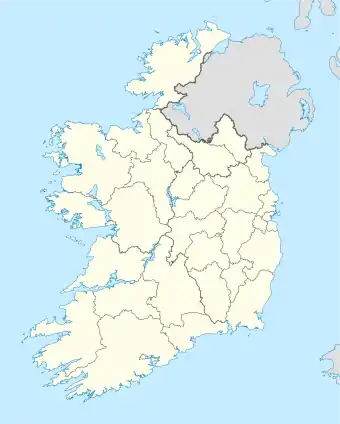
 斯沃司 於愛爾蘭的位置 | |
| 坐标:53°27′35″N 6°13′05″W | |
| 國家 (NUTS I) | 愛爾蘭 |
| Assembly (NUTS II) | South-East[2] |
| Region (NUTS III) | 都柏林地區[3] |
| 郡(NUTS IV) | 芬戈郡[4] |
| 省份 | 倫斯特省 |
| 國會選區 | 都柏林北區 都柏林西區 |
| 歐洲議會選區 | 都柏林 |
| 建城 | 560年 |
| 郡城 | 1994年 |
| 城市 | 待定 |
| 地方政府 | 芬戈爾郡議會 |
| 選舉分區 | 7
|
| 面积[5] | |
| • Swords & Kinsealy-Drinan Census Towns | 11 平方公里(4 平方英里) |
| • Swords CT | 10 平方公里(4 平方英里) |
| • Kinsealy-Drinan CT | 1 平方公里(0.4 平方英里) |
| Source: Central Statistics Office | |
| 海拔 | 3 米(10 英尺) |
| 人口(2011) | |
| • 市区 | 42,738 |
| 居民称谓 | Fingalian |
| Irish Grid Reference | O184469 |
自20世紀90年代中期以來,斯沃司已經看到了先進的店面,公共建築,行人道。
2011 Irish Business Against Litter(IBAL)為6000人以上的城市做調查,斯沃司名列愛爾蘭城市清潔的第二名。 [6]
氣候
| 斯沃司(都柏林機場)(1981-2010平均值)气候平均数据 | |||||||||||||
|---|---|---|---|---|---|---|---|---|---|---|---|---|---|
| 月份 | 1月 | 2月 | 3月 | 4月 | 5月 | 6月 | 7月 | 8月 | 9月 | 10月 | 11月 | 12月 | 全年 |
| 历史最高温℃(℉) | 16.5 (61.7) |
16.2 (61.2) |
17.2 (63) |
20.5 (68.9) |
23.5 (74.3) |
25.7 (78.3) |
27.6 (81.7) |
28.7 (83.7) |
24.6 (76.3) |
21.0 (69.8) |
18.0 (64.4) |
16.2 (61.2) |
28.7 (83.7) |
| 平均高温℃(℉) | 8.1 (46.6) |
8.3 (46.9) |
10.2 (50.4) |
12.1 (53.8) |
14.8 (58.6) |
17.6 (63.7) |
19.5 (67.1) |
19.2 (66.6) |
17.0 (62.6) |
13.6 (56.5) |
10.3 (50.5) |
8.3 (46.9) |
13.3 (55.9) |
| 每日平均气温℃(℉) | 5.3 (41.5) |
5.3 (41.5) |
6.8 (44.2) |
8.3 (46.9) |
10.9 (51.6) |
13.6 (56.5) |
15.6 (60.1) |
15.3 (59.5) |
13.4 (56.1) |
10.5 (50.9) |
7.4 (45.3) |
5.6 (42.1) |
9.8 (49.6) |
| 平均低温℃(℉) | 2.4 (36.3) |
2.3 (36.1) |
3.4 (38.1) |
4.6 (40.3) |
6.9 (44.4) |
9.6 (49.3) |
11.7 (53.1) |
11.5 (52.7) |
9.8 (49.6) |
7.3 (45.1) |
4.5 (40.1) |
2.8 (37) |
6.4 (43.5) |
| 历史最低温℃(℉) | −9.5 (14.9) |
−6.7 (19.9) |
−7.9 (17.8) |
−4.0 (24.8) |
−1.6 (29.1) |
2.1 (35.8) |
4.6 (40.3) |
2.4 (36.3) |
1.2 (34.2) |
−3.3 (26.1) |
−8.4 (16.9) |
−12.2 (10) |
−12.2 (10) |
| 平均降雨量㎜(英寸) | 62.6 (2.465) |
48.8 (1.921) |
52.7 (2.075) |
54.1 (2.13) |
59.5 (2.343) |
66.7 (2.626) |
56.2 (2.213) |
73.3 (2.886) |
59.5 (2.343) |
79.0 (3.11) |
72.9 (2.87) |
72.7 (2.862) |
758.0 (29.843) |
| 平均降雨日数 | 17 | 15 | 17 | 15 | 15 | 14 | 16 | 16 | 15 | 17 | 17 | 17 | 191 |
| 平均降雪日数 | 4.6 | 4.2 | 2.8 | 1.2 | 0.2 | 0.0 | 0.0 | 0.0 | 0.0 | 0.0 | 0.8 | 2.9 | 16.6 |
| 平均相对湿度(%) | 80.6 | 75.7 | 71.0 | 68.3 | 68.0 | 68.3 | 69.0 | 69.3 | 71.5 | 75.1 | 80.3 | 83.1 | 73.3 |
| 每日平均日照时数 | 1.9 | 2.7 | 3.5 | 5.3 | 6.2 | 5.8 | 5.3 | 5.1 | 4.3 | 3.3 | 2.4 | 1.7 | 3.9 |
| 来源:Met Eireann[7] | |||||||||||||
參考文獻
- logainm.ie Oficial Placenames Database of Ireland
- My Plan Map Viewer Boundary Layer: Regional Assemblies (NUTS II)
- My Plan Map Viewer Boundary Layer: Regional Authorities (NUTS III)
- My Plan Map Viewer Boundary Layer: Counties (NUTS IV)
- Census 2011 Population Classified by Area Table CD116
- http://www.ibal.ie/press_releases/2012/PressRelease(1).pdf
- Met Eireann
This article is issued from Wikipedia. The text is licensed under Creative Commons - Attribution - Sharealike. Additional terms may apply for the media files.
