桑迪河 (俄勒冈州)
桑迪河(英語:)是哥倫比亞河的一条支流,长约56-英里(90-),位于美国俄勒冈州西北部。经美國地質調查局(USGS)测算,桑迪河与Bull Run River汇合处(距离河口18.4英里(29.6))的平均流量为2,300立方英尺每秒(65立方每秒)。
| Sandy River 桑迪河 | |
 胡德山与桑迪河 | |
| 名称起源:Named Quicksand River in 1805 by Lewis and Clark because of "emence quantitys of sand" at the mouth; apparently shortened to Sandy River locally by 1845–50[1] | |
| 国家 | 美国 |
|---|---|
| 州 | 俄勒冈州 |
| 县 | 克拉克默斯縣、姆尔特诺默县 |
| 源头 | 胡德山 |
| - 海拔 | 5,225 ft(1,593 m)[2] |
| - 坐标 | 45°22′32″N 121°43′45″W [3] |
| 河口 | 哥倫比亞河 |
| - 位置 | 俄勒冈州姆尔特诺默县Troutdale附近 |
| - 海拔 | 10 ft(3 m)[3] |
| - 坐标 | 45°34′05″N 122°24′03″W [3] |
| 长度 | 56 mi(90 km)[4] |
| 流域面积 | 508 mi²(1,316 km²)[5] |
| 流量 | Dodge Park附近,距离河口18.4英里(29.6) |
| - 平均流量 | 2,300 ft³/s(65 m³/s)[6][7] |
| - 最大流量 | 84,400 ft³/s(2,390 m³/s) |
| - 最小流量 | 45 ft³/s(1 m³/s) |
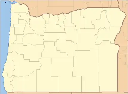 桑迪河河口在俄勒冈州的位置
| |
参考文献
- McArthur, Lewis A.; McArthur, Lewis L. . Portland, Oregon: Oregon Historical Society Press. 2003: 846–47. ISBN 0-87595-277-1.
- Source elevation derived from Google Earth search using GNIS source coordinates.
- . Geographic Names Information System (GNIS). United States Geological Survey (USGS). November 28, 1980 [December 15, 2009].
- . Sandy River Basin Watershed Council. 2007 [September 19, 2008]. (原始内容存档于2018-10-13).
- Taylor, Barbara. (PDF). Portland General Electric. December 1998 [October 6, 2009]. (原始内容 (pdf)存档于2015年4月27日).
- . United States Geological Survey. 2008 [May 5, 2008]. (原始内容存档于2015-04-02).
- Average discharge rate was calculated by adding average annual discharge rates for 10 calendar years, 1994–2003, from USGS records and dividing by 10.
外部链接
- Sandy River Basin Watershed Council 页面存档备份,存于
- Brinckman, Jonathan. . The Oregonian. October 12, 2002 [2015-03-03]. (原始内容存档于2011-09-27).
- Tubing tips Sandy River
This article is issued from Wikipedia. The text is licensed under Creative Commons - Attribution - Sharealike. Additional terms may apply for the media files.
