聖露西區
| Saint Lucy | |
|---|---|
| 区 | |
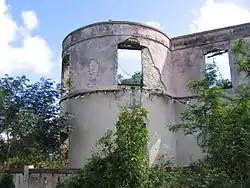 鲁因斯 | |
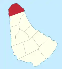 Map of Barbados showing the Saint Lucy parish | |
| 坐标:13°18′N 59°37′W | |
| 国家 | 巴巴多斯 |
| 最大村庄 | 彻克霍尔 |
| 政府 | |
| • 类型 | Parliamentary democracy |
| • Parliamentary seats | 1 |
| 面积 | |
| • 总计 | 36 平方公里(14 平方英里) |
| 人口(2010 census) | |
| • 總計 | 9,758人 |
| • 密度 | 270人/平方公里(700人/平方英里) |
| ISO 3166码 | BB-07[1] |
聚居地
以下就是该教区内的镇、村、聚居地、社区和其他小村庄:
- Alexandra
- Allmans
- Antilles Flat
- Archers
- Avis Town
- Babbs
- Backstage Alley
- Bathesda Chapel
- Benthams
- Bishops
- Blacksage Alley
- Bourbon
- Bright Hall
- Bromefield
- Cave Hill
- Chance Hall
- 彻克霍尔
- Church Hill
- Clinketts
- Clinketts Gardens
- Coconut Hall
- 康奈尔镇
- Content
- Cottage
- 克拉布希尔
- Date Tree Hill
- Duppies
- Durham
- 费尔菲尔德
- Flatfield
- Fosters
- Free Hill
- Friendship
- Fustic
- Fustic Village
- Grape Hall
- Graveyard
- Great Head
- Greenidges
- Half Acre
- Hannays
- Harrises
- Harrisons
- Hope
- Husbands
- Jemmotts
- Jordan's Cowpen
- Josey Hill
- 兰伯茨
- Maycocks
- Moontown
- Mount Gay
- Mount Poyer
- Mount View
- Mount View Drive
- Nesfield
- Northumberland
- North Point Gardens
- Pickerings
- Pie Corner
- Retreat
- Roaches
- Rockfield
- Rock Hall
- Saint Clements
- Saint Swithins
- Salmonds
- Seaview
- Shermans
- Spring Garden
- Spring Hall
- Sutherland Hill
- Swampy Town
- The Landlock
- The Spout
- Trents
- Upper Salmonds
- Well Road
- iso:code:3166:BB, International Organization for Standardization
This article is issued from Wikipedia. The text is licensed under Creative Commons - Attribution - Sharealike. Additional terms may apply for the media files.
