里彭
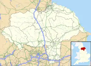
里彭(英语:Ripon,/ˈrɪpən/),英国英格兰北约克郡城市,位于哈罗盖特以北19公里。总人口16,702(2011年)[1]。它位於烏爾河的兩條支流,即拉韦河(River Laver)和斯科爾河(River Skell)的交匯處。里彭大教堂和噴泉修道院遺址位於此地。
| 里彭 | |
| 英語: | |
| — 市 — | |
.jpg.webp) 集市 |
|

|
|
 里彭 | |
| 人口 | 16,7022011年[1] |
|---|---|
| OS格網參考 | SE312714 |
| - 倫敦 | 227 mi(365 km)SSE |
| 民政教區 | Ripon |
| 區域 | 哈羅蓋特區 |
| 郡區 | 北約克郡 |
| 約克郡-亨伯 | |
| 國家 | 英格蘭 |
| 主權國家 | 英國 |
| 郵鎮 | RIPON |
| 郵區 | HG4 |
| 電話區號 | 01765 |
| 警察 | North Yorkshire |
| 消防 | North Yorkshire |
| 救護 | Yorkshire |
| 歐洲議會選區 | Yorkshire and the Humber |
| 英國國會選區 | 斯基普頓和里彭 |
| 網站 | www.ripon.org |
里彭最初是由聖威弗烈建立起來的,當時名為“Inhrypum”,後來先後被維京人、諾曼人控制。金雀花王朝時,里彭作為羊毛和布匹貿易中心興起,但後來並未受到工業革命的影響。
交通

里彭運河
里彭鐵路站原本是里茲-諾薩勒頓鐵路上的一個站台[2],但是1960年代因英國政府縮減鐵路開支而關閉[3],但至今當地仍有團體試圖說服政府恢復其運營[2][3][4]。
A1、B6265和A61公路均進過此地[5]。1766年修通的里彭運河本來已在1956年廢棄,但1988年開始至1996年逐步重新疏通[6]。
参考文献
- UK Census. . Nomis. Office for National Statistics. 2011 [7 January 2019].
- . Northern Echo. [1 February 2009]. (原始内容存档于2 January 2010).
- . BBC News Online (BBC). 11 May 2004 [4 January 2010]. (原始内容存档于2004-07-16).
- . Yorkshire Post. [2 March 2015]. (原始内容存档于2015-07-13).
- . VisitRipon.org. [1 February 2009]. (原始内容存档于2008-12-30).
- . WaterScape.com. Canal and River Trust. [13 May 2016]. (原始内容存档于2012-03-05).
- . France. Archant Life. 2006 [7 March 2012]. (原始内容存档于2010-03-30).
This article is issued from Wikipedia. The text is licensed under Creative Commons - Attribution - Sharealike. Additional terms may apply for the media files.
