阿爾及爾區
阿爾及爾區(英語:,或譯阿爾古瑞區)是美国地质调查局太空地质学研究计划(Astrogeology Research Program)对火星表面划分的30个区域之一,编号为MC-26。[1]
阿爾及爾區
阿爾及爾區
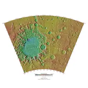
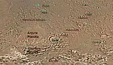
阿爾及爾區覆盖了火星西经0°至60°、南纬30°至65°的区域。形似笑脸的伽勒撞击坑便位于该区。
| 维基共享资源中相关的多媒体资源:阿爾及爾區 |
参考文献
- Davies, M.E.; Batson, R.M.; Wu, S.S.C. "Geodesy and Cartography" in Kieffer, H.H.; Jakosky, B.M.; Snyder, C.W.; Matthews, M.S., Eds. Mars. University of Arizona Press: Tucson, 1992.
This article is issued from Wikipedia. The text is licensed under Creative Commons - Attribution - Sharealike. Additional terms may apply for the media files.
