雪脊
| 雪脊 Le Crêt de la Neige | |
|---|---|
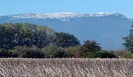 在安省图瓦里所见的雪脊 | |
| 最高点 | |
| 海拔 | 1,720(5,640英尺) |
| 相對高度 | 1,260(4,130英尺) |
| 母峰 | Mont Blanc |
| 46°16′15″N 5°56′22″E | |
| 地理 | |
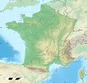 雪脊 Le Crêt de la Neige 雪脊在法国的位置 | |
| 位置 | |
| 山脈 | 汝拉山脉 |
参考资料
- (法文)Crêt de la Neige, carte IGN, géoportail.gouv.fr, consulté le 16 août 2017
- (英文)Retrieved from the Swisstopo topographic maps . The lowest col between the Jura and the Alps is located at the Canal d’Entreroches (in Switzerland), at approximately 460 metres above sea level.
This article is issued from Wikipedia. The text is licensed under Creative Commons - Attribution - Sharealike. Additional terms may apply for the media files.
