揚馬延
扬马延(挪威語:,東部城市挪威語:[jɑn ˈmɑ̀ɪən])[1]是一個位于北冰洋的火山島嶼,是挪威的领土。島長約55 km(34 mi),面积约 377 km2(146 sq mi),貝倫火山附近約114.2 km(71.0 mi)被冰川所覆蓋,約佔島上約1/3的面積。气候恶劣,寒冷多雾。
| 揚馬延 | |
|---|---|
 NASA衛星圖像中的揚馬延島,貝倫火山則被雪覆蓋 | |
 揚馬延的位置(深綠色) | |
| 地理 | |
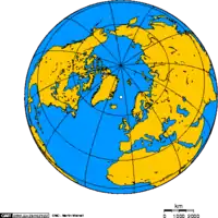 揚馬延的位置(深綠色) | |
| 位置 | 北冰洋 |
| 坐标 | 70°59′N 8°32′W |
| 面積 | 377平方(146平方英里) |
| 海岸線 | 124,100米(407,200英尺) |
| 最高海拔 | 2,277米(7,470英尺) |
| 最高點 | 貝倫火山 |
| 管轄 | |
| 郡 | 諾爾蘭郡 |
| 最大聚居地 | 奥隆金比恩(人口18) |
| 人口统计 | |
| 人口 | 18 |
氣候
| 揚馬延气候平均数据 | |||||||||||||
|---|---|---|---|---|---|---|---|---|---|---|---|---|---|
| 月份 | 1月 | 2月 | 3月 | 4月 | 5月 | 6月 | 7月 | 8月 | 9月 | 10月 | 11月 | 12月 | 全年 |
| 历史最高温℃(℉) | 6.6 (43.9) |
6.8 (44.2) |
4.8 (40.6) |
7.0 (44.6) |
9.4 (48.9) |
18.1 (64.6) |
16.2 (61.2) |
15.7 (60.3) |
13.4 (56.1) |
11.6 (52.9) |
10.0 (50) |
6.8 (44.2) |
18.1 (64.6) |
| 平均高温℃(℉) | −1.4 (29.5) |
−2.2 (28) |
−1.8 (28.8) |
−0.7 (30.7) |
1.9 (35.4) |
4.8 (40.6) |
7.3 (45.1) |
7.7 (45.9) |
5.9 (42.6) |
3.7 (38.7) |
1.7 (35.1) |
−0.2 (31.6) |
2.2 (36) |
| 平均低温℃(℉) | −6.3 (20.7) |
−7.8 (18) |
−7.4 (18.7) |
−5.8 (21.6) |
−2.3 (27.9) |
0.6 (33.1) |
3.5 (38.3) |
3.9 (39) |
2.1 (35.8) |
−1.3 (29.7) |
−3.5 (25.7) |
−5.4 (22.3) |
−2.5 (27.5) |
| 历史最低温℃(℉) | −26.6 (−15.9) |
−27.9 (−18.2) |
−24.8 (−12.6) |
−21.4 (−6.5) |
−11.6 (11.1) |
−4.7 (23.5) |
−1.6 (29.1) |
−2.3 (27.9) |
−5.0 (23) |
−13.4 (7.9) |
−15.2 (4.6) |
−22.5 (−8.5) |
−27.9 (−18.2) |
| 平均降水量㎜(英寸) | 66 (2.6) |
47 (1.85) |
48 (1.89) |
44 (1.73) |
25 (0.98) |
27 (1.06) |
36 (1.42) |
54 (2.13) |
74 (2.91) |
75 (2.95) |
67 (2.64) |
65 (2.56) |
628 (24.72) |
| 平均降水日数(≥ 1 mm) | 13 | 11 | 12 | 9 | 8 | 8 | 8 | 11 | 13 | 15 | 13 | 13 | 134 |
| 平均相对湿度(%) | 83 | 83 | 84 | 83 | 85 | 87 | 89 | 87 | 83 | 83 | 81 | 82 | 84.2 |
| 每月平均日照时数 | 0 | 28 | 62 | 120 | 155 | 150 | 124 | 93 | 60 | 31 | 0 | 0 | 823 |
| 来源 #1:Worldwide Bioclimatic Classification System[2] | |||||||||||||
| 来源 #2:The Weather Network (humidity and precipitation days),[3] World Climate data (sunshine hours)[4] | |||||||||||||

參見
- 斯瓦巴和揚馬延
参考文献
引用
- Berulfsen, Bjarne. . Oslo: H. Aschehoug & Co (W Nygaard). 1969: 157 (挪威语).
- . [5 December 2011]. Java plugin required
- . The Weather Network. [2012-07-11].
- . [2012-07-11].
来源
- 书籍
- Umbreit, Andreas (2005) Spitsbergen : Svalbard - Franz Josef Land - Jan Mayen, 3rd ed., Chalfont St. Peter : Bradt Travel Guides, ISBN 1-84162-092-0
外部連結
| 维基共享资源中相关的多媒体资源:揚馬延 |
- 《世界概况》上有关Jan Mayen的条目
- 开放式目录计划中和揚馬延相关的内容
 維基媒體的Jan Mayen地圖集
 维基导游中有關揚馬延的旅遊指南
- www.jan-mayen.no
- Jan Mayen year round webcam
- Jan Mayen at Norwegian Polar Institute
- TopoJanMayen – Interactive map of Jan Mayen by the Norwegian Polar Institute
- Photographs and information on Jan Mayen
- Satellite Radar image of Jan Mayen
- Glaciers of Jan Mayen
- www.janmayen2011.org - a site about JX5O - international ham radio expedition to Jan Mayen island in 2011
- Structurae数据库中LORAN-C Transmission Mast (Jan Mayen)的数据
- Weather forecasts for Jan Mayen at yr.no (Norwegian Meteorological institute and NR
This article is issued from Wikipedia. The text is licensed under Creative Commons - Attribution - Sharealike. Additional terms may apply for the media files.
