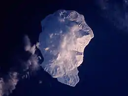
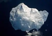
磨勘留島
磨勘留島(俄语:,羅馬化:,日语:/ Makanru tō */?)俄语音译马坎鲁希岛,是俄罗斯千岛群岛中部的一个岛屿。俄语和日语的岛名皆来源于阿依努语的「makun-rur」(後方的海水)。在二战前此岛属于日本领土,行政区划属北海道占守郡。二战后苏联撕毁日苏中立条约并出兵占领该岛。
| 磨勘留島 Маканруши 磨勘留島 | |
|---|---|
 磨勘留島冬景,2001年1月,於北峰頂部 | |
| 地理 | |
 | |
| 位置 | 鄂霍次克海 |
| 坐标 | 49.78°N 154.43°E |
| 群岛 | 千島群島 |
| 面積 | 49平方(19平方英里) |
| 最高海拔 | 1169m |
| 最高點 | 三高山 |
| 管轄 | |
俄羅斯 | |
| 人口统计 | |
| 人口 | 俄羅斯邊境警備隊駐紮(2011年) |
地理

磨勘留島
千岛群岛的中北部,温禰古丹島的西北方相隔约26公里的岛屿。南北长约10公里,中部为标高1171公尺的三高山()。磨勘留島的西部大约20千米的地方有一名为的三角形岩礁又名帆掛岩(),为海狮和海鸟的繁殖地。
参考文献
- 『北方領土地名考』 北方領土問題对策協会編(日文)、1978年
延伸閱讀
- Gorshkov, G. S. Volcanism and the Upper Mantle Investigations in the Kurile Island Arc. Monographs in geoscience. New York: Plenum Press, 1970. ISBN 0-306-30407-4
- Krasheninnikov, Stepan Petrovich, and James Greive. The History of Kamtschatka and the Kurilski Islands, with the Countries Adjacent. Chicago: Quadrangle Books, 1963.
- Rees, David. The Soviet Seizure of the Kuriles. New York: Praeger, 1985. ISBN 0-03-002552-4
- Takahashi, Hideki, and Masahiro Ōhara. Biodiversity and Biogeography of the Kuril Islands and Sakhalin. Bulletin of the Hokkaido University Museum, no. 2-. Sapporo, Japan: Hokkaido University Museum, 2004.
This article is issued from Wikipedia. The text is licensed under Creative Commons - Attribution - Sharealike. Additional terms may apply for the media files.
