密苏里州各县列表
美国密苏里州一共有114个县和一个独立市。随着路易斯安那购地和路易斯安那州于1812年加入联邦,密苏里领地召开的第一次大会上将领地划分为5个县。随后的大多数县都是从这5个县中划分出来的。1836年,联邦政府通过普拉特购地()从美洲原住民部落购买了密西西比河东岸8156平方公里土地,这些土地就成了密苏里州的西北部地区,包括安德鲁县、艾奇逊县、布坎南县、霍尔特县、诺德韦县和普拉特县[1]。

密苏里州县政府的级别处在市政府和州政府之间。主要负责维护道理、保障安全、起诉罪犯和征收赋税。这一级别政府所选举的官员包括警长、检察官和估税官[2]。
密苏里州的大部分县都是以政治家命名的。比如其中的一个卡斯县最初以美国总统马丁·范布伦命名为范布伦县,然后又在1848年美国总统选举期间改名为卡斯县来支持范布伦在竞选中的民主党对手刘易斯·卡斯。其它的县则是以战争英雄、自然资源、探险家和曾经的美国领地来命名[3]。
圣路易斯是一个独立市,不属于任何一个县。1876年,该市居民通过投票选举从圣路易斯县分裂出去。在整个美国,除了弗吉尼亚州以外,圣路易斯是仅有的三个独立市之一,另外两个分别是马里兰州的巴尔的摩和内华达州的卡森城[4]。
所有人口统计数据来源于2010年美国人口普查。根据该普查数据,密苏里州共有598万8927位居民,于2000年美国人口普查的结果相比增加了7%,平均每个县有5万2078人。其中圣路易斯县以99万8954居于榜首,沃思县只有2171人排在最后。平均每个县的面积为1550平方公里,最大的德克萨斯县有3054平方公里,最小的圣路易斯市只有160平方公里[5]。
以下表格会在每一个县的名称后面列出其联邦资料处理标准代码(简称FIPS代码),该代码是联邦政府用来区分各州和各县的唯一识别码[6]。密苏里州的FIPS代码是29,结合任何一个县的代码则为“29XXX”。所有的FIPS代码将链接至该县最近的一次人口普查数据[7]。
各县列表
| 县 |
FIPS代码 [7] |
县治 [8] |
成立 [8] |
来源 [3] |
辞源 [3][9][10] |
人口 [5] |
面积 [8] |
地图 |
|---|---|---|---|---|---|---|---|---|
| 亚代尔县 | 001 | 柯克斯维尔 | 1841 | 梅肯县 | 第7任肯塔基州州长约翰·亚岱尔 | 25,607 | 1471平方公里 |  |
| 安德鲁县 | 003 | 萨凡纳 | 1841 | 普拉特购地 | 安德鲁·杰克逊·戴维斯(,唯灵论者,定居圣路易斯的传教士 | 17,291 | 1127平方公里 |  |
| 艾奇逊县 | 005 | 罗克波特 | 1843 | 霍尔特县和普拉特购地 | 密苏里州民主党联邦参议员 戴维·赖斯·艾奇逊 | 5,685 | 1412平方公里 | 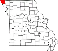 |
| 奥德雷恩县 | 007 | 墨西哥 | 1831 | 卡勒韦县、门罗县和罗尔斯县 | 詹姆斯·H·奥德雷恩,1812年战争上校,密苏里州议员 | 25,529 | 1795平方公里 | 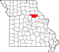 |
| 巴里县 | 009 | 卡斯维尔 | 1835 | 格林县 | 威廉·T·巴里,法学家、美国邮政署署长 | 35,597 | 2018平方公里 |  |
| 巴顿县 | 011 | 拉马尔 | 1855 | 杰斯帕县 | 大卫·巴顿(),密苏里州最早的联邦参议员之一 | 12,402 | 1538平方公里 |  |
| 贝茨县 | 013 | 巴特勒 | 1841 | 卡斯县 | 第二任密苏里州长弗雷德里克·贝茨 | 17,049 | 2196平方公里 | 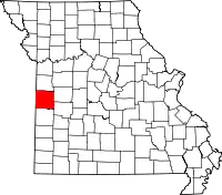 |
| 本顿县 | 015 | 华沙 | 1835 | 佩蒂斯县和格林县 | 密苏里州联邦参议员托马斯·哈特·本顿 | 19,056 | 1826平方公里 | 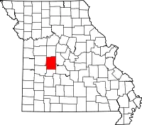 |
| 波林格县 | 017 | 马伯希尔 | 1851 | 开普吉拉多县、麦迪逊、斯托达德县和韦恩县 | 乔治·弗雷德里克·波林格,州内早期居民 | 12,363 | 1608平方公里 |  |
| 布恩县 | 019 | 哥伦比亚市 | 1821 | 霍华德县 | 丹尼尔·布恩,拓荒者、探险家和猎人 | 162,642 | 1774平方公里 |  |
| 布坎南县 | 021 | 圣约瑟夫 | 1838 | 普拉特购地 | 第15任美国总统詹姆斯·布坎南 | 89,201 | 1062平方公里 |  |
| 巴特勒县 | 023 | 波普拉布拉夫 | 1849 | 韦恩县 | 联邦众议员威廉·O·巴特勒 | 42,794 | 1808平方公里 |  |
| 考德威尔县 | 025 | 金斯顿 | 1836 | 雷县 | 不确定,可能是一位名叫约翰·考德威尔()的印第安哨兵,或是同样叫这个名字的肯塔基州副州长,或德克萨斯独立宣言的签置人之一马修·考德威尔() | 9,424 | 1111平方公里 |  |
| 卡勒韦县 | 027 | 富尔顿 | 1821 | 布恩县、霍华德县和蒙哥马利县 | 詹姆斯·卡勒韦(),1812年战争士兵,丹尼尔·布恩的孙子 | 44,332 | 2183平方公里 |  |
| 康登县 | 029 | 康登顿 | 1841 | 本顿县、摩根县和普瓦斯基县 | 查尔斯·普拉特,第一世康登伯爵,英格兰法学家、法官、辉格党政治家,公民自由的倡导者 | 44,002 | 1696平方公里 |  |
| 开普吉拉多县 | 031 | 杰克逊 | 1812 | 最早的五县之一 | 吉拉尔多先生,法国军官,这一地区的早期探险家 | 75,674 | 1500平方公里 |  |
| 卡罗尔县 | 033 | 卡罗尔顿 | 1833 | 雷县 | 查尔斯·卡罗尔,大陆会议代表,马里兰州联邦参议员 | 9,295 | 1800平方公里 |  |
| 卡特县 | 035 | 范布伦 | 1859 | 俄勒冈县、雷诺兹县、里普利县和香农县 | 早期定居者金利·卡特() | 6,265 | 1316平方公里 |  |
| 卡斯县 | 037 | 哈里森维尔 | 1833 | 杰克逊县 | 密歇根州联邦参议员刘易斯·卡斯 | 99,478 | 1810平方公里 | 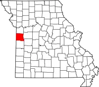 |
| 锡达县 | 039 | 斯托克顿 | 1845 | 戴德县和圣克莱尔县 | 以丰富的美国红香杉()命名 | 13,982 | 1233平方公里 |  |
| 沙里顿县 | 041 | 基特维尔 | 1821 | 霍华德县 | 同名河流,是密苏里河的支流 | 7,831 | 1958平方公里 |  |
| 克里斯蒂安县 | 043 | 奥扎克 | 1859 | 格林县、托尼县和韦伯斯特县 | 美国独立战争上校威廉·克里斯蒂安() | 77,422 | 1458平方公里 | 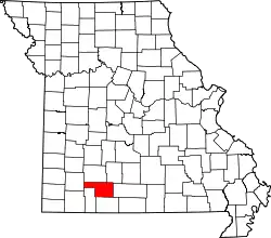 |
| 克拉克县 | 045 | 卡霍卡 | 1836 | 刘易斯县 | 威廉·克拉克,探险家,士兵,领地总督 | 7,139 | 1313平方公里 |  |
| 克莱县 | 047 | 自由城 | 1822 | 雷县 | 来自肯塔基州的联邦参议员和演说家亨利·克莱 | 221,939 | 1026平方公里 | 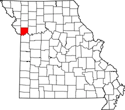 |
| 克林顿县 | 049 | 普拉茨堡 | 1833 | 克莱县 | 乔治·克林顿、纽约州州长,军人,被认为是美国开国元勋之一 | 20,743 | 1085平方公里 |  |
| 科尔县 | 051 | 杰斐逊城 | 1820 | 库珀县 | 史蒂芬·科尔(),开拓定居者 | 75,990 | 1015平方公里 |  |
| 库珀县 | 053 | 布恩维尔 | 1818 | 霍华德县 | 沙舍尔·本杰明·库珀(),开拓定居者 | 17,601 | 1463平方公里 |  |
| 克劳福德县 | 055 | 斯蒂尔维尔 | 1829 | 加斯科内德县 | 威廉·H·克劳福德,乔治亚州联邦参议员,美国财政部长、法官 | 24,696 | 1924平方公里 | 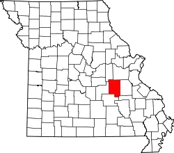 |
| 戴德县 | 057 | 格林菲尔德 | 1841 | 巴里县和波尔克县 | 第二次塞米诺尔战争美国陆军第4步兵团弗朗西斯·L·戴德()少校 | 7,883 | 1269平方公里 |  |
| 达拉斯县 | 059 | 布法罗 | 1841 | 波尔克县 | 美国副总统乔治·M·达拉斯 | 16,777 | 1404平方公里 | 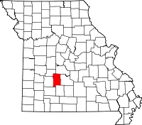 |
| 戴维斯县 | 061 | 加勒廷 | 1836 | 雷县 | 约瑟夫·汉密尔顿·戴维斯(),印第安纳州龙骑兵指挥官 | 8,433 | 1469平方公里 | 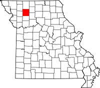 |
| 迪卡尔布县 | 063 | 梅斯维尔 | 1843 | 克林顿县 | 约翰·迪卡尔布(),美国独立战争大陆军少将 | 12,892 | 1098平方公里 |  |
| 登特县 | 065 | 塞勒姆 | 1851 | 克劳福德县和香农县 | 詹姆斯·登特(),开拓定居者 | 15,657 | 1953平方公里 |  |
| 道格拉斯县 | 067 | 阿瓦 | 1857 | 奥札克县 | 史蒂芬·A·道格拉斯(),伊利诺伊州联邦参议员,1860年美国总统选举民主党总统候选人 | 13,684 | 2111平方公里 | 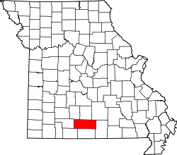 |
| 邓克林县 | 069 | 肯尼特 | 1843 | 斯托达德县 | 丹尼尔·邓克林(),第五任密苏里州州长 | 31,953 | 1414平方公里 |  |
| 富兰克林县 | 071 | 尤宁 | 1818 | 圣路易斯县 | 美国开国元勋本杰明·富兰克林 | 101,492 | 2388平方公里 | 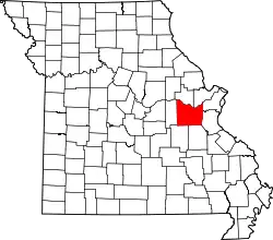 |
| 加斯科内德县 | 073 | 赫曼 | 1821 | 富兰克林县 | 同名河流,密苏里河的一条支流 | 15,222 | 1347平方公里 |  |
| 金特里县 | 075 | 奥尔巴尼 | 1841 | 克林顿县 | 理查德·金特里(),塞米诺尔战争中杰出的美军上校 | 6,738 | 1274平方公里 |  |
| 格林县 | 077 | 斯普林菲尔德 | 1833 | 克劳福德县和韦恩县 | 美国独立战争大陆军少将内森纳尔·格林() | 275,174 | 1748平方公里 |  |
| 格兰迪县 | 079 | 托伦顿 | 1839 | 利文斯顿县 | 费利克斯·格伦迪,田纳西州联邦众议员和参议员,第13任美国司法部长 | 10,261 | 1129平方公里 | 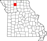 |
| 哈里森县 | 081 | 贝瑟尼 | 1843 | 戴维斯县 | 密苏里州联邦众议员艾伯特·G·哈里森() | 8,957 | 1878平方公里 |  |
| 亨利县 | 083 | 克林顿 | 1834 | 拉法叶县 | 弗吉尼亚州州长,美国革命领导人帕特里克·亨利 | 22,272 | 1818平方公里 |  |
| 希科里县 | 085 | 赫米蒂奇 | 1845 | 本顿县和波尔克县 | 第7任美国总统安德鲁·杰克逊服兵役期间的昵称 | 9,627 | 1033平方公里 |  |
| 霍尔特县 | 087 | 俄勒冈 | 1841 | 普拉特购地 | 密苏里州议员大卫·莱斯·霍尔特 | 4,912 | 1197平方公里 |  |
| 霍华德县 | 089 | 费耶特 | 1816 | 圣查尔斯县和圣路易斯县 | 本杰明·霍华德(),肯塔基州联邦众议员,密苏里领地总督,1812年战争准将 | 10,144 | 1207平方公里 | 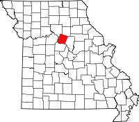 |
| 豪厄尔县 | 091 | 西普莱恩斯 | 1857 | 俄勒冈县 | 不确定,可能是开拓定居者乔赛亚·豪厄尔() | 40,400 | 2404平方公里 |  |
| 艾昂县 | 093 | 艾昂顿 | 1857 | 麦迪逊县、雷诺兹县、圣弗朗索瓦县、华盛顿县和韦恩县 | 当有丰富的铁矿,县名与铁的英文均为“Iron” | 10,630 | 1427平方公里 | 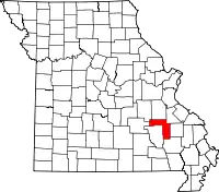 |
| 杰克逊县 | 095 | 堪萨斯城 独立城 | 1826 | 拉法叶县 | 美国总统安德鲁·杰克逊 | 674,158 | 1567平方公里 |  |
| 杰斯帕县 | 097 | 迦太基 | 1841 | 巴里县 | 威廉·杰斯帕(),美国独立战争士兵 | 117,404 | 1658平方公里 |  |
| 杰佛逊县 | 099 | 希尔斯伯勒 | 1818 | 圣路易斯县和圣热讷维耶沃县 | 美国总统托马斯·杰佛逊 | 218,733 | 1702平方公里 |  |
| 约翰逊县 | 101 | 沃伦斯堡 | 1834 | 拉法叶县 | 美国副总统理查德·门特·约翰逊 | 52,595 | 2152平方公里 |  |
| 诺克斯县 | 103 | 伊代纳 | 1843 | 苏格兰县 | 亨利·诺克斯,首任美国战争部长,大陆军火炮统领 | 4,131 | 1311平方公里 | 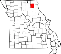 |
| 拉克利德县 | 105 | 莱巴嫩 | 1849 | 康登县、普瓦斯基县和赖特县 | 皮埃尔·拉克利备(),圣路易斯的创立者 | 35,571 | 1984平方公里 |  |
| 拉法叶县 | 107 | 列克星敦 | 1821 | 库珀县 | 拉法耶特侯爵,法国军官,美国独立战争将军 | 33,381 | 1629平方公里 |  |
| 劳伦斯县 | 109 | 芒特弗农 | 1843 | 巴里县和戴德县 | 美国海军军官詹姆斯·劳伦斯() | 38,634 | 1588平方公里 | 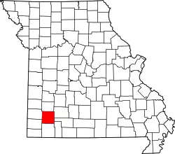 |
| 劉易斯縣 | 111 | 蒙蒂塞洛 | 1833 | 馬里昂縣 | Meriwether Lewis (1774–1809),路易斯安那領地探索者及總督 | 10,211 | 505平方英里 (1,308平方公里) |  |
| 林肯縣 | 113 | Troy | 1818 | St. Charles County | Disputed; either Lincoln County, Kentucky (birthplace of Christopher Clark, a Missouri legislator who advocated for the county's creation),[11] or for Benjamin Lincoln (1733–1810), an American revolutionary war general | 52,566 | 630平方英里 (1,632平方公里) | [[Image:Map of Missouri highlighting {{{English}}} County.svg|80px|alt=A state map highlighting Lincoln County in the eastern part of the state.位置的地圖|標示出林肯縣位置的地圖]] |
| 林縣 | 115 | Linneus | 1837 | Chariton County | Lewis F. Linn (1796–1843), a Jacksonian Democratic U.S. Senator for Missouri | 12,761 | 620平方英里 (1,606平方公里) | [[Image:Map of Missouri highlighting {{{English}}} County.svg|80px|alt=A state map highlighting Linn County in the northern part of the state.位置的地圖|標示出林縣位置的地圖]] |
| 利文斯頓縣 | 117 | Chillicothe | 1837 | Carroll County | Edward Livingston (1764–1836), a prominent American jurist and statesman, influential in the drafting of the Louisiana Civil Code of 1825, a civil code based largely on the Napoleonic Code | 15,195 | 535平方英里 (1,386平方公里) | [[Image:Map of Missouri highlighting {{{English}}} County.svg|80px|alt=A state map highlighting Livingston County in the northwestern part of the state.位置的地圖|標示出利文斯頓縣位置的地圖]] |
| 梅肯縣 | 121 | Macon | 1837 | Chariton and Randolph counties | Nathaniel Macon (1758–1837), member of the United States House of Representatives from 1791 to 1815 who briefly served in the American Revolutionary War | 15,566 | 804平方英里 (2,082平方公里) | [[Image:Map of Missouri highlighting {{{English}}} County.svg|80px|alt=A state map highlighting Macon County in the northern part of the state.位置的地圖|標示出梅肯縣位置的地圖]] |
| 麥迪遜縣 | 123 | Fredericktown | 1818 | Cape Girardeau and Sainte Genevieve counties | James Madison (1751–1836), politician and political philosopher who served as the fourth President of the United States, and one of the Founding Fathers of the United States | 12,226 | 497平方英里 (1,287平方公里) | [[Image:Map of Missouri highlighting {{{English}}} County.svg|80px|alt=標示出麥迪遜縣位置的地圖|標示出麥迪遜縣位置的地圖]] |
| 瑪麗縣 | 125 | Vienna | 1855 | Osage and Pulaski counties | Maries River, possibly a corruption of the French word marais meaning "marsh" or "swamp" | 9,176 | 528平方英里 (1,368平方公里) | [[Image:Map of Missouri highlighting {{{English}}} County.svg|80px|alt=A state map highlighting Maries County in the middle part of the state.位置的地圖|標示出瑪麗縣位置的地圖]] |
| 馬里昂縣 | 127 | Palmyra | 1826 | Ralls County | Francis Marion (1732–1795), a military officer who served in the American Revolutionary War | 28,781 | 438平方英里 (1,134平方公里) | [[Image:Map of Missouri highlighting {{{English}}} County.svg|80px|alt=A state map highlighting Marion County in the northeastern part of the state.位置的地圖|標示出馬里昂縣位置的地圖]] |
| 麥克唐納縣 | 119 | Pineville | 1847 | Newton County | Alexander McDonald, American Revolutionary War sergeant | 23,083 | 540平方英里 (1,399平方公里) | [[Image:Map of Missouri highlighting {{{English}}} County.svg|80px|alt=A state map highlighting McDonald County in the southwestern corner of the state.位置的地圖|標示出麥克唐納縣位置的地圖]] |
| 默瑟縣 | 129 | Princeton | 1845 | Grundy County | John F. Mercer (1759–1821), an American lawyer, planter, and Governor of Maryland | 3,785 | 454平方英里 (1,176平方公里) | [[Image:Map of Missouri highlighting {{{English}}} County.svg|80px|alt=A state map highlighting Mercer County in the northwestern part of the state.位置的地圖|標示出默瑟縣位置的地圖]] |
| 米勒縣 | 131 | Tuscumbia | 1837 | Cole and Pulaski counties | John Miller (1781–1846), an American publisher and politician from St. Louis, Missouri. He was the fourth Governor of Missouri and represented Missouri in the U.S. House | 24,748 | 592平方英里 (1,533平方公里) | [[Image:Map of Missouri highlighting {{{English}}} County.svg|80px|alt=A state map highlighting Miller County in the middle part of the state.位置的地圖|標示出米勒縣位置的地圖]] |
| 密西西比縣 | 133 | Charleston | 1842 | Scott County | Mississippi River, the second-longest river in the United States which forms Missouri's eastern border | 14,358 | 413平方英里 (1,070平方公里) | [[Image:Map of Missouri highlighting {{{English}}} County.svg|80px|alt=A state map highlighting Mississippi County in the southeastern part of the state.位置的地圖|標示出密西西比縣位置的地圖]] |
| 莫尼托縣 | 135 | California | 1845 | Cole and Morgan counties | Moniteau Creek; "moniteau" is a French spelling of manitou, the Algonquian Great Spirit | 15,607 | 417平方英里 (1,080平方公里) | [[Image:Map of Missouri highlighting {{{English}}} County.svg|80px|alt=A state map highlighting Moniteau County in the middle part of the state.位置的地圖|標示出莫尼托縣位置的地圖]] |
| 門羅縣 | 137 | Paris | 1831 | Ralls County | James Monroe (1758–1831), fifth President of the United States who crafted the Missouri Compromise | 8,840 | 646平方英里 (1,673平方公里) | [[Image:Map of Missouri highlighting {{{English}}} County.svg|80px|alt=A state map highlighting Monroe County in the northeastern part of the state.位置的地圖|標示出門羅縣位置的地圖]] |
| 蒙哥馬利縣 | 139 | Montgomery City | 1818 | St. Charles County | Richard Montgomery (1738–1775), an Irish-born soldier who first served in the British Army and later became a brigadier-general in the Continental Army during the Revolutionary War | 12,236 | 539平方英里 (1,396平方公里) | [[Image:Map of Missouri highlighting {{{English}}} County.svg|80px|alt=A state map highlighting Montgomery County in the eastern part of the state.位置的地圖|標示出蒙哥馬利縣位置的地圖]] |
| 摩根縣 | 141 | Versailles | 1833 | Cooper County | Daniel Morgan (c. 1736–1802), American pioneer, soldier, and United States Representative from Virginia | 20,565 | 598平方英里 (1,549平方公里) | [[Image:Map of Missouri highlighting {{{English}}} County.svg|80px|alt=A state map highlighting Morgan County in the middle part of the state.位置的地圖|標示出摩根縣位置的地圖]] |
| 新馬德里縣 | 143 | New Madrid | 1812 | One of the five original counties | Madrid, Spain | 18,956 | 678平方英里 (1,756平方公里) | [[Image:Map of Missouri highlighting {{{English}}} County.svg|80px|alt=A state map highlighting New Madrid County in the southeastern part of the state.位置的地圖|標示出新馬德里縣位置的地圖]] |
| 牛頓縣 | 145 | Neosho | 1838 | Barry County | John Newton (1755–1780), legendary soldier of the American Revolution | 58,114 | 626平方英里 (1,621平方公里) | [[Image:Map of Missouri highlighting {{{English}}} County.svg|80px|alt=A state map highlighting Newton County in the southwestern part of the state.位置的地圖|標示出牛頓縣位置的地圖]] |
| 諾德韋縣 | 147 | Maryville | 1843 | Andrew County, the Platte Purchase | Nodaway River, a 120-英里(190-) long river in southwest Iowa and northwest Missouri | 23,370 | 877平方英里 (2,271平方公里) | [[Image:Map of Missouri highlighting {{{English}}} County.svg|80px|alt=A state map highlighting Nodaway County in the northwestern part of the state.位置的地圖|標示出諾德韋縣位置的地圖]] |
| 俄勒岡縣 | 149 | Alton | 1841 | Ripley County | Oregon Territory | 10,881 | 792平方英里 (2,051平方公里) | [[Image:Map of Missouri highlighting {{{English}}} County.svg|80px|alt=A state map highlighting Oregon County in the southern part of the state.位置的地圖|標示出俄勒岡縣位置的地圖]] |
| 歐塞奇縣 | 151 | Linn | 1841 | Gasconade County | Osage River, a 360英里(580) long tributary of the Missouri River in central Missouri; the name of the river is probably derived from a French corruption of "Washazhe" – the name of the Osage Native Americans | 13,878 | 606平方英里 (1,570平方公里) | [[Image:Map of Missouri highlighting {{{English}}} County.svg|80px|alt=A state map highlighting Osage County in the middle part of the state.位置的地圖|標示出歐塞奇縣位置的地圖]] |
| 奧札克縣 | 153 | Gainesville | 1841 | Taney County | Ozark Mountains – Ozark is the anglicized form of the French "aux arcs", an abbreviation of "Aux Arkansas", which means in the county of Arkansas | 9,723 | 747平方英里 (1,935平方公里) | [[Image:Map of Missouri highlighting {{{English}}} County.svg|80px|alt=A state map highlighting Ozark County in the southern part of the state.位置的地圖|標示出奧札克縣位置的地圖]] |
| 佩米斯科特縣 | 155 | Caruthersville | 1851 | New Madrid County | An American Indian word meaning "liquid mud" | 18,296 | 493平方英里 (1,277平方公里) | [[Image:Map of Missouri highlighting {{{English}}} County.svg|80px|alt=A state map highlighting Pemiscot County in the southeastern corner of the state.位置的地圖|標示出佩米斯科特縣位置的地圖]] |
| 佩里縣 | 157 | Perryville | 1821 | Sainte Genevieve County | Oliver Hazard Perry (1785–1819), naval officer in the War of 1812 against Britain, earned the title "Hero of Lake Erie" for leading American forces in a decisive naval victory at the Battle of Lake Erie | 18,971 | 475平方英里 (1,230平方公里) | [[Image:Map of Missouri highlighting {{{English}}} County.svg|80px|alt=A state map highlighting Perry County in the southeastern part of the state.位置的地圖|標示出佩里縣位置的地圖]] |
| 佩蒂斯縣 | 159 | Sedalia | 1833 | Cooper and Saline counties | Spencer Darwin Pettis (1802–1831), U.S. Representative from Missouri | 42,201 | 685平方英里 (1,774平方公里) | [[Image:Map of Missouri highlighting {{{English}}} County.svg|80px|alt=A state map highlighting Pettis County in the western part of the state.位置的地圖|標示出佩蒂斯縣位置的地圖]] |
| 費爾普斯縣 | 161 | Rolla | 1857 | Crawford County | John S. Phelps (1814–1886), a politician, soldier during the American Civil War, and twenty-third Governor of Missouri | 45,156 | 673平方英里 (1,743平方公里) | [[Image:Map of Missouri highlighting {{{English}}} County.svg|80px|alt=A state map highlighting Phelps County in the middle part of the state.位置的地圖|標示出費爾普斯縣位置的地圖]] |
| 派克縣 | 163 | Bowling Green | 1818 | St. Charles County | Zebulon Pike (1778–1813), American soldier and explorer for whom Pikes Peak in Colorado is also named | 18,516 | 673平方英里 (1,743平方公里) | [[Image:Map of Missouri highlighting {{{English}}} County.svg|80px|alt=A state map highlighting Pike County in the northeastern part of the state.位置的地圖|標示出派克縣位置的地圖]] |
| 普拉特縣 | 165 | Platte City | 1838 | Part of the Platte Purchase | Platte River, a tributary of the Missouri River, which is in turn named for the French word "platte" meaning flat or shallow | 89,322 | 420平方英里 (1,088平方公里) | [[Image:Map of Missouri highlighting {{{English}}} County.svg|80px|alt=A state map highlighting Platte County in the northwestern part of the state.位置的地圖|標示出普拉特縣位置的地圖]] |
| 波爾克縣 | 167 | Bolivar | 1835 | Greene County | James K. Polk (1795–1849), 11th President of the United States | 31,137 | 637平方英里 (1,650平方公里) | [[Image:Map of Missouri highlighting {{{English}}} County.svg|80px|alt=A state map highlighting Polk County in the southwestern part of the state.位置的地圖|標示出波爾克縣位置的地圖]] |
| 普瓦斯基縣 | 169 | Waynesville | 1833 | Crawford County | Kazimierz Pulaski (1745–1779), Polish soldier of fortune in the American Revolutionary War, he saved the life of George Washington and became a general in the Continental Army | 52,274 | 547平方英里 (1,417平方公里) | [[Image:Map of Missouri highlighting {{{English}}} County.svg|80px|alt=A state map highlighting Pulaski County in the middle part of the state.位置的地圖|標示出普瓦斯基縣位置的地圖]] |
| 普特南縣 | 171 | Unionville | 1843 | Adair and Sullivan counties | Israel Putnam (1718–1790), an American army general who fought with distinction at the Battle of Bunker Hill during the American Revolutionary War | 4,979 | 518平方英里 (1,342平方公里) | [[Image:Map of Missouri highlighting {{{English}}} County.svg|80px|alt=A state map highlighting Putnam County in the northern part of the state.位置的地圖|標示出普特南縣位置的地圖]] |
| 羅爾斯縣 | 173 | New London | 1821 | Pike County | Daniel Ralls, a Missouri State Representative | 10,167 | 471平方英里 (1,220平方公里) | [[Image:Map of Missouri highlighting {{{English}}} County.svg|80px|alt=A state map highlighting Ralls County in the northeastern part of the state.位置的地圖|標示出羅爾斯縣位置的地圖]] |
| 蘭道夫縣 | 175 | Huntsville | 1829 | Chariton and Ralls counties | John Randolph of Roanoke (1773–1833), a leader in Congress from Virginia and spokesman for the "Old Republican" | 25,414 | 482平方英里 (1,248平方公里) | [[Image:Map of Missouri highlighting {{{English}}} County.svg|80px|alt=A state map highlighting Randolph County in the northern part of the state.位置的地圖|標示出蘭道夫縣位置的地圖]] |
| 雷縣 | 177 | Richmond | 1820 | Howard County | John Ray, Missouri State Representative | 23,494 | 570平方英里 (1,476平方公里) | [[Image:Map of Missouri highlighting {{{English}}} County.svg|80px|alt=A state map highlighting Ray County in the northwestern part of the state.位置的地圖|標示出雷縣位置的地圖]] |
| 雷諾茲縣 | 179 | Centerville | 1845 | Shannon County | Thomas Reynolds (1796–1844), governor of Missouri from 1840 to 1844 | 6,696 | 811平方英里 (2,100平方公里) | [[Image:Map of Missouri highlighting {{{English}}} County.svg|80px|alt=A state map highlighting Reynolds County in the southeastern part of the state.位置的地圖|標示出雷諾茲縣位置的地圖]] |
| 里普利縣 | 181 | Doniphan | 1831 | Wayne County | Eleazer Wheelock Ripley (1782–1839), Brigadier General in the War of 1812 | 14,100 | 630平方英里 (1,632平方公里) | [[Image:Map of Missouri highlighting {{{English}}} County.svg|80px|alt=A state map highlighting Ripley County in the southeastern part of the state.位置的地圖|標示出里普利縣位置的地圖]] |
| 聖查爾斯縣 | 183 | Saint Charles | 1812 | One of the five original counties | St. Charles Borromeo (1538–1584), an Italian saint and cardinal of the Roman Catholic Church | 360,485 | 561平方英里 (1,453平方公里) | [[Image:Map of Missouri highlighting {{{English}}} County.svg|80px|alt=A state map highlighting Saint Charles County in the eastern part of the state.位置的地圖|標示出聖查爾斯縣位置的地圖]] |
| 聖克萊爾縣 | 185 | Osceola | 1841 | Rives (now Henry) County | Arthur St. Clair (1737–1818), an American soldier and Governor of the Northwest Territory | 9,805 | 677平方英里 (1,753平方公里) | [[Image:Map of Missouri highlighting {{{English}}} County.svg|80px|alt=A state map highlighting Saint Clair County in the western part of the state.位置的地圖|標示出聖克萊爾縣位置的地圖]] |
| 聖弗朗索瓦縣 | 187 | Farmington | 1821 | Jefferson, Ste. Genevieve and Washington counties | St. Francis of Assisi (c. 1182–1226), a Catholic deacon and the founder of the Order of Friars Minor, more commonly known as the Franciscans | 65,359 | 450平方英里 (1,165平方公里) | [[Image:Map of Missouri highlighting {{{English}}} County.svg|80px|alt=A state map highlighting Saint Francois County in the southeastern part of the state.位置的地圖|標示出聖弗朗索瓦縣位置的地圖]] |
| 聖路易斯縣 | 189 | Clayton | 1812 | One of the five original counties | King Louis IX (1214–1270), King of France from 1226 until his death | 1,000,438 | 508平方英里 (1,316平方公里) | [[Image:Map of Missouri highlighting {{{English}}} County.svg|80px|alt=A state map highlighting Saint Louis County in the eastern part of the state.位置的地圖|標示出聖路易斯縣位置的地圖]] |
| 聖路易斯 | 510 | St. Louis | 1876 | Created in 1876 when city residents voted to secede from St. Louis County | King Louis IX (1214–1270), King of France from 1226 until his death | 319,294 | 61.9平方英里 (160平方公里) | [[Image:Map of Missouri highlighting {{{English}}}.svg|80px|alt=A state map highlighting Saint Louis City in the eastern part of the state.位置的地圖|標示出聖路易斯位置的地圖]] |
| 聖熱訥維耶沃縣 | 186 | Ste. Genevieve | 1812 | One of the five original counties | St. Genevieve (c. 420 – c. 510), the patron saint of Paris in Roman Catholic and Eastern Orthodox tradition | 18,145 | 502平方英里 (1,300平方公里) | [[Image:Map of Missouri highlighting {{{English}}} County.svg|80px|alt=A state map highlighting Sainte Genevieve County in the southeastern part of the state.位置的地圖|標示出聖熱訥維耶沃縣位置的地圖]] |
| 薩林縣 | 195 | Marshall | 1820 | Cooper County | Local hot springs | 23,370 | 756平方英里 (1,958平方公里) | [[Image:Map of Missouri highlighting {{{English}}} County.svg|80px|alt=A state map highlighting Saline County in the northwestern part of the state.位置的地圖|標示出薩林縣位置的地圖]] |
| 斯凱勒縣 | 197 | Lancaster | 1843 | Adair County | Philip Schuyler (1733–1804), a general in the American Revolution and a United States Senator from New York | 4,431 | 308平方英里 (798平方公里) | [[Image:Map of Missouri highlighting {{{English}}} County.svg|80px|alt=A state map highlighting Schuyler County in the northern part of the state.位置的地圖|標示出斯凱勒縣位置的地圖]] |
| 蘇格蘭縣 | 199 | Memphis | 1841 | Clark, Lewis, and Shelby counties | Scotland (country) | 4,843 | 438平方英里 (1,134平方公里) | [[Image:Map of Missouri highlighting {{{English}}} County.svg|80px|alt=A state map highlighting Scotland County in the northeastern part of the state.位置的地圖|標示出蘇格蘭縣位置的地圖]] |
| 斯科特縣 | 201 | Benton | 1822 | New Madrid County | John Guier Scott (1819–1892), a U.S. Representative from Missouri | 39,191 | 421平方英里 (1,090平方公里) | [[Image:Map of Missouri highlighting {{{English}}} County.svg|80px|alt=A state map highlighting Scott County in the southeastern part of the state.位置的地圖|標示出斯科特縣位置的地圖]] |
| 香農縣 | 203 | Eminence | 1837 | Ripley County | George Shannon (1785–1836), member of the Lewis and Clark Expedition | 8,441 | 1,004平方英里 (2,600平方公里) | [[Image:Map of Missouri highlighting {{{English}}} County.svg|80px|alt=A state map highlighting Shannon County in the southern part of the state.位置的地圖|標示出香農縣位置的地圖]] |
| 謝爾比縣 | 205 | Shelbyville | 1835 | Marion County | Isaac Shelby (1750–1826), the first and fifth Governor of Kentucky | 6,373 | 501平方英里 (1,298平方公里) | [[Image:Map of Missouri highlighting {{{English}}} County.svg|80px|alt=A state map highlighting Shelby County in the northeastern part of the state.位置的地圖|標示出謝爾比縣位置的地圖]] |
| 斯托達德縣 | 207 | Bloomfield | 1835 | New Madrid County | Amos Stoddard (1762–1813), the only commandant of Upper Louisiana for the French Republic and the only commandant for the District of Louisiana for the United States in 1804 during the handover of the Louisiana Purchase | 29,968 | 827平方英里 (2,142平方公里) | [[Image:Map of Missouri highlighting {{{English}}} County.svg|80px|alt=A state map highlighting Stoddard County in the southeastern part of the state.位置的地圖|標示出斯托達德縣位置的地圖]] |
| 斯通縣 | 209 | Galena | 1851 | Taney County | William Stone, first elected judge of Taney County | 32,202 | 463平方英里 (1,199平方公里) | [[Image:Map of Missouri highlighting {{{English}}} County.svg|80px|alt=A state map highlighting Stone County in the southwestern part of the state.位置的地圖|標示出斯通縣位置的地圖]] |
| 沙利文縣 | 211 | Milan | 1843 | Linn County | John Sullivan (1740–1795), American Revolutionary War general | 6,714 | 651平方英里 (1,686平方公里) | [[Image:Map of Missouri highlighting {{{English}}} County.svg|80px|alt=A state map highlighting Sullivan County in the northern part of the state.位置的地圖|標示出沙利文縣位置的地圖]] |
| 托尼縣 | 213 | Forsyth | 1837 | Greene County | Roger Brooke Taney (1777–1864), eleventh United States Attorney General and fifth Chief Justice of the United States | 51,675 | 632平方英里 (1,637平方公里) | [[Image:Map of Missouri highlighting {{{English}}} County.svg|80px|alt=A state map highlighting Taney County in the southwestern part of the state.位置的地圖|標示出托尼縣位置的地圖]] |
| 德克薩斯縣 | 215 | Houston | 1843 | Shannon and Wright counties | Republic of Texas | 26,008 | 1,179平方英里 (3,054平方公里) | [[Image:Map of Missouri highlighting {{{English}}} County.svg|80px|alt=A state map highlighting Texas County in the southern part of the state.位置的地圖|標示出德克薩斯縣位置的地圖]] |
| 弗農縣 | 217 | Nevada | 1851 | Bates County | Miles Vernon, Missouri State Senator – the county was originally defined as having the same boundaries as Bates county, but was later declared unconstitutional and changed | 21,159 | 834平方英里 (2,160平方公里) | [[Image:Map of Missouri highlighting {{{English}}} County.svg|80px|alt=A state map highlighting Vernon County in the southwestern part of the state.位置的地圖|標示出弗農縣位置的地圖]] |
| 沃倫縣 | 219 | Warrenton | 1833 | Montgomery County | Joseph Warren (1741–1775), Revolutionary War doctor and general | 32,513 | 432平方英里 (1,119平方公里) | [[Image:Map of Missouri highlighting {{{English}}} County.svg|80px|alt=A state map highlighting Warren County in the eastern part of the state.位置的地圖|標示出沃倫縣位置的地圖]] |
| 華盛頓縣 | 221 | Potosi | 1813 | Sainte Genevieve County | George Washington (1732–1799), commander of the Continental Army in the American Revolutionary War and first President of the United States | 25,195 | 760平方英里 (1,968平方公里) | [[Image:Map of Missouri highlighting {{{English}}} County.svg|80px|alt=A state map highlighting Washington County in the southeastern part of the state.位置的地圖|標示出華盛頓縣位置的地圖]] |
| 韋恩縣 | 223 | Greenville | 1818 | Cape Girardeau and Lawrence counties | Anthony Wayne (1745–1796), United States Army general and statesman | 13,521 | 761平方英里 (1,971平方公里) | [[Image:Map of Missouri highlighting {{{English}}} County.svg|80px|alt=A state map highlighting Wayne County in the southeastern part of the state.位置的地圖|標示出韋恩縣位置的地圖]] |
| 韋伯斯特縣 | 225 | Marshfield | 1855 | Greene County | Daniel Webster (1782–1852), U.S. Secretary of State and Senator from Massachusetts | 36,202 | 593平方英里 (1,536平方公里) | [[Image:Map of Missouri highlighting {{{English}}} County.svg|80px|alt=A state map highlighting Webster County in the southwestern part of the state.位置的地圖|標示出韋伯斯特縣位置的地圖]] |
| 沃思縣 | 227 | Grant City | 1861 | Gentry County | William J. Worth (1794–1849), a United States general during the Mexican–American War | 2,171 | 266平方英里 (689平方公里) | [[Image:Map of Missouri highlighting {{{English}}} County.svg|80px|alt=A state map highlighting Worth County in the northwestern part of the state.位置的地圖|標示出沃思縣位置的地圖]] |
| 賴特縣 | 229 | Hartville | 1841 | Pulaski County | Silas Wright (1795–1847), an American Democratic politician and Governor of New York | 18,815 | 682平方英里 (1,766平方公里) | [[Image:Map of Missouri highlighting {{{English}}} County.svg|80px|alt=A state map highlighting Wright County in the southern part of the state.位置的地圖|標示出賴特縣位置的地圖]] |
参考资料
- . Missouri State Government Web. [2013-07-02]. (原始内容存档于2013-07-19).
- . Missouri State Government Web. [2010-01-09]. (原始内容存档于2010-01-10).
- . Missouri State Government Web. [2013-07-02]. (原始内容存档于2013-05-29).
- . City of St. Louis. [2011-06-06]. (原始内容存档于2011-06-07).
- . U.S. Census Bureau. [2013-07-02]. (原始内容存档于2013-07-02).
- . National Institute of Standards and Technology. [2013-06-07]. (原始内容存档于2013年9月29日).
- . US Environmental Protection Agency. [2013-07-02]. (原始内容存档于2014-03-21).
- . National Association of Counties. [2009-09-17]. (原始内容存档于2010-01-24).
- Beatty, Michael. . McFarland Press. 2001. ISBN 0-7864-1025-6.
- Coulet du Gard, René; Coulet Western, Dominique. . Editions des Deux Mondes. 1981. ISBN 0-939586-00-2.
- Howard Louis Conard. . 1901: 68.